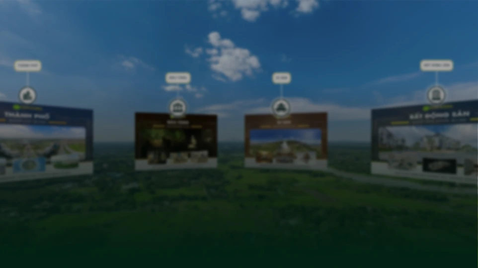
THỰC TRẠNG VÀ NHU CẦU THỊ TRƯỜNG
MẤT NHIỀU THỜI GIAN, NHÂN LỰC
Các phương pháp đo đạc thủ công (máy toàn đạc, GPS tĩnh) mất nhiều thời gian và nhân lực khi triển khai trên diện rộng hoặc địa hình phức tạp (đồi núi, sình lầy).
CHI PHÍ CAO, DỮ LIỆU RỜI RẠC
Chi phí cao, dữ liệu rời rạc (chỉ có các điểm tọa độ), khó hình dung trực quan toàn cảnh và tiềm ẩn rủi ro mất an toàn cho nhân sự khảo sát.
CẦN GIẢI PHÁP SỐ HOÁ TOÀN DIỆN
Cần một giải pháp thu thập dữ liệu nhanh, chính xác cao (độ sai số cm) Có khả năng số hóa toàn diện khu vực khảo sát dưới dạng 3D.
THỰC TRẠNG VÀ NHU CẦU THỊ TRƯỜNG
Thiết bị game
VR takes immersive gaming to another level. From deep environmental interactions to puzzle solving.
Thiết kế
From design concept to the showroom, create and manage workflows with better collaboration.
Đào tạo
From high-risk safety simulations and maintenance procedures to soft skills like public speaking.
Khám phá sáu ứng dụng thực tiễn của dịch vụ

All-in-one platform
Flexible API integration capability, helping seamlessly connect multiple fields and serve the diverse usage purposes of enterprises.
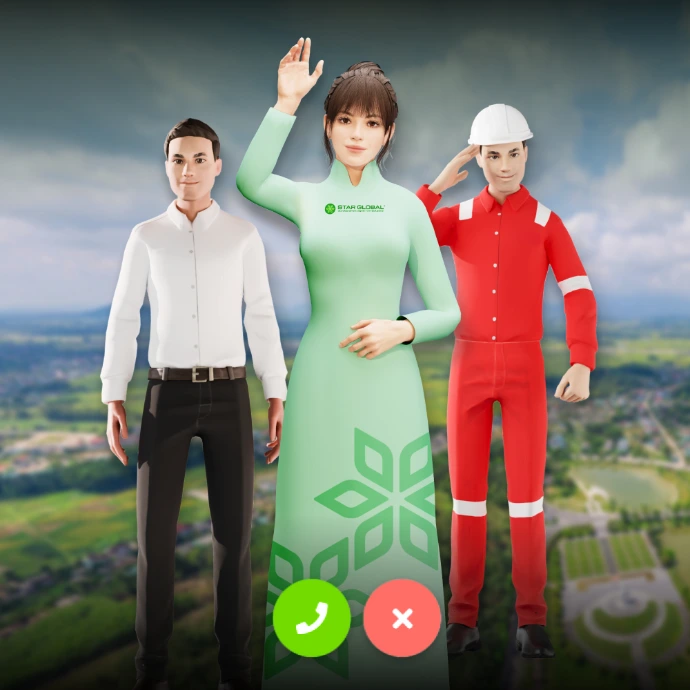
AI integration capability
Equipped with advanced AI technology, pre-integrated with virtual assistants, chatbots, voice bots, and even digital humans to automate and optimize the interaction experience.
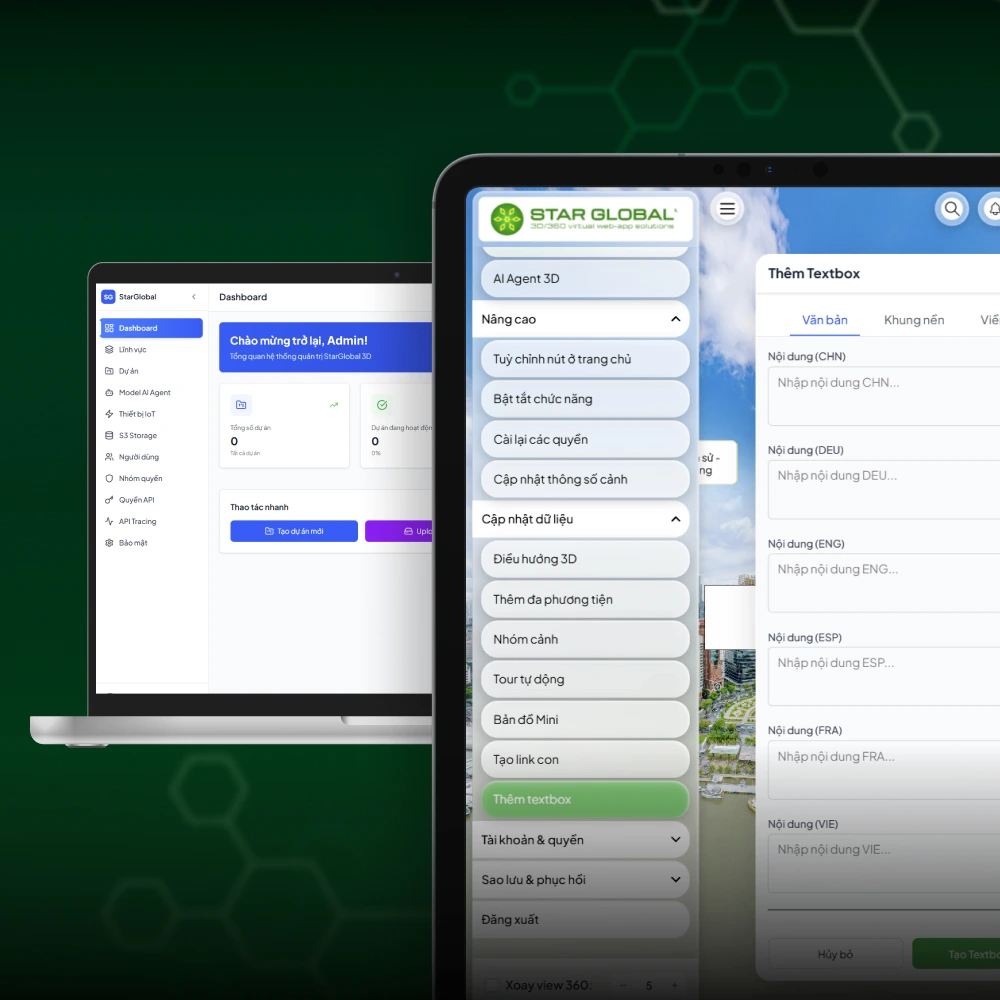
Intuitive interface
Easily visualize asset reality, perform simple management operations, and quickly retrieve data.
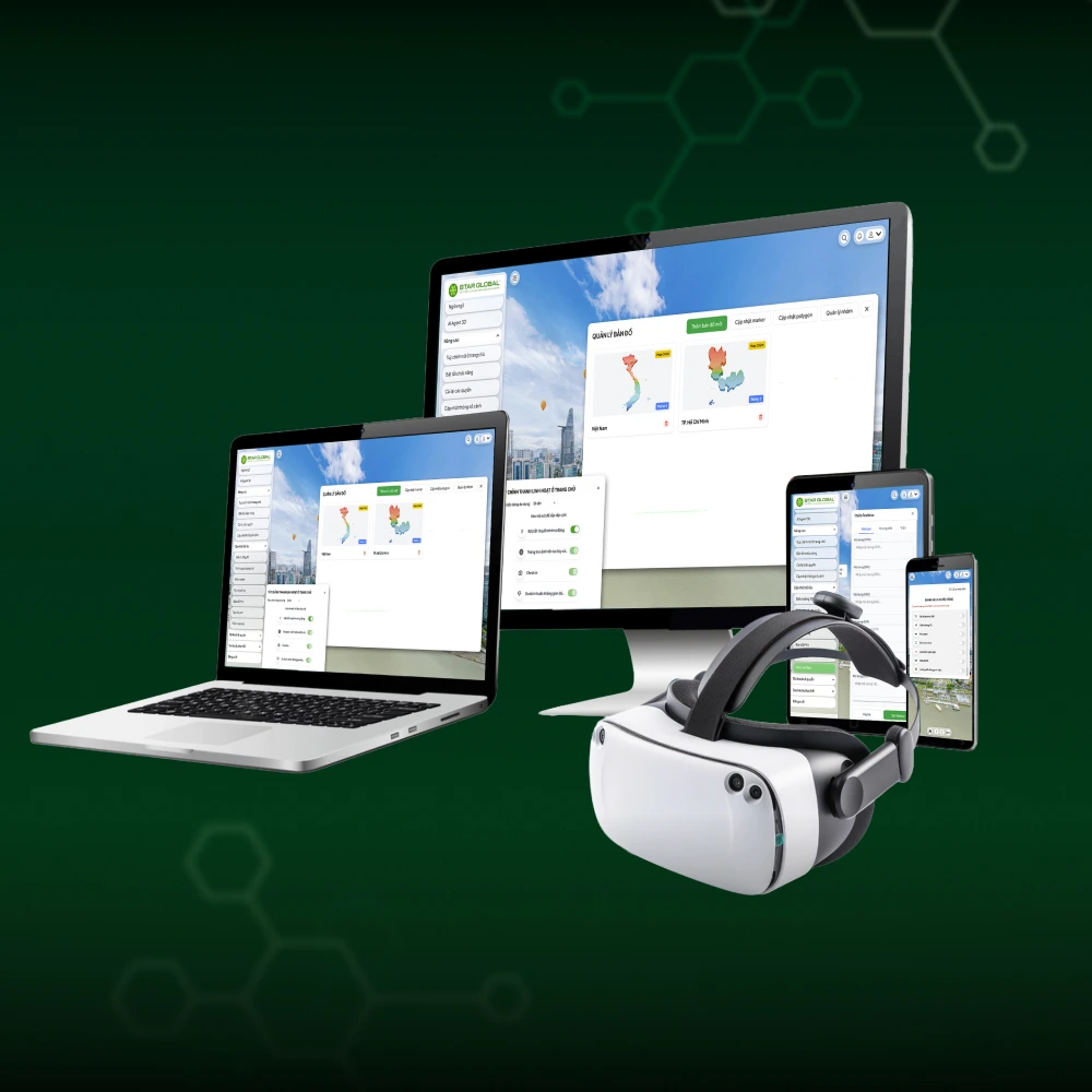
Multi-device compatibility
Smooth and flexible operation on all hardware platforms, from phones, tablets, personal computers to high-tech devices like VR and AR glasses.
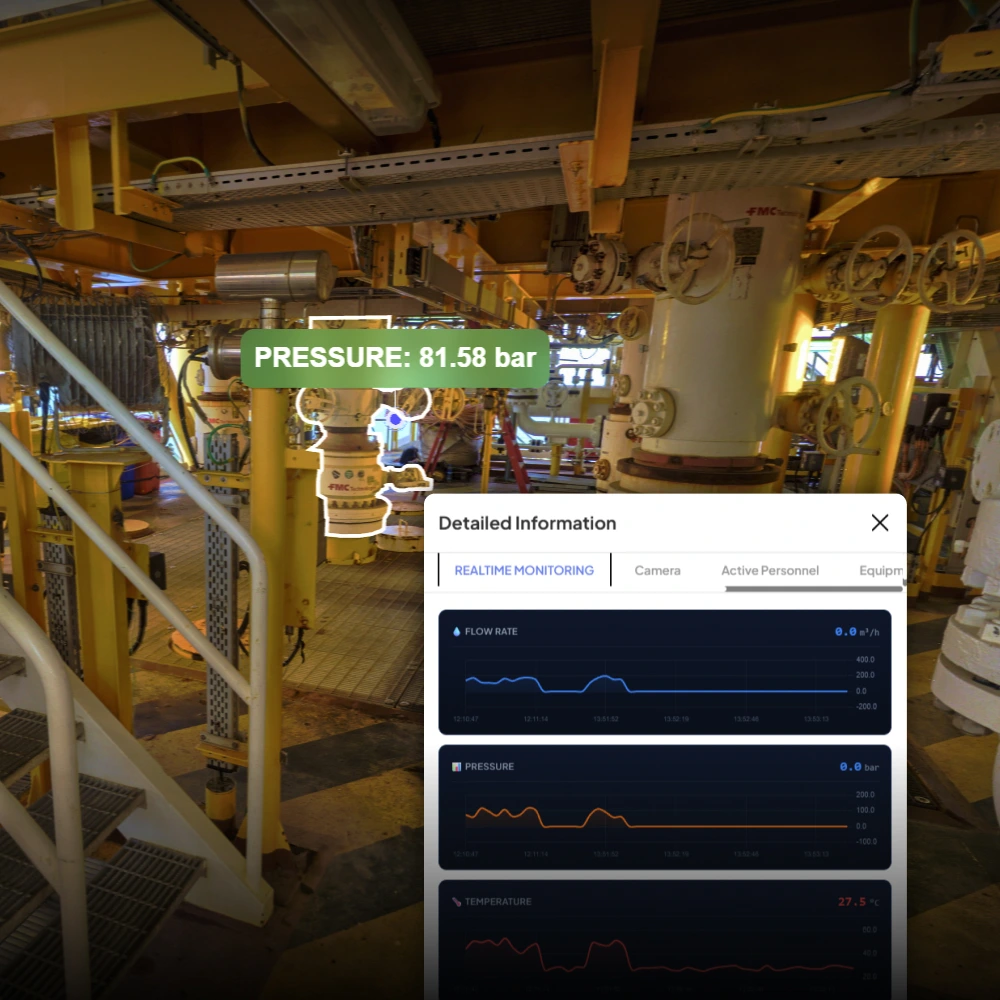
Data integration linkage
Allows powerful data linking from various sources, optimizing management processes in an object-oriented manner and synchronizing accurate information through an API gateway.
Unlimited expansion
Unlimited development capability thanks to easy updates of 3D/360 spatial data, proactively upgrading new features by module, and flexibly integrating with third-party applications.